Precision Aerial Data Solutions
Transform your infrastructure, construction, and mining projects with survey-grade UAV mapping, LiDAR analysis, and 3D modeling. Reduce field time, improve accuracy, and make faster data-driven decisions.
Core Services
We deliver comprehensive aerial data solutions tailored to your industry needs, from initial capture to final analysis.
UAV Photogrammetry
High-resolution aerial imagery processed into precise orthomosaics and digital surface models for detailed site analysis.
- Survey-grade accuracy
- Real-time processing
- Multi-spectral imaging
LiDAR Mapping
Advanced laser scanning technology capturing detailed 3D point clouds for complex terrain and vegetation analysis.
- Penetrates vegetation
- Millimeter accuracy
- Dense point clouds
3D Modeling
Transform raw data into actionable 3D models for visualization, measurement, and volumetric analysis.
- Mesh generation
- Texture mapping
- Volume calculations
Data Analysis
Comprehensive analysis and reporting of aerial data with custom dashboards and insights for decision-making.
- Custom reports
- Change detection
- Trend analysis
Industry Solutions
Tailored aerial data solutions for your specific industry challenges and opportunities.
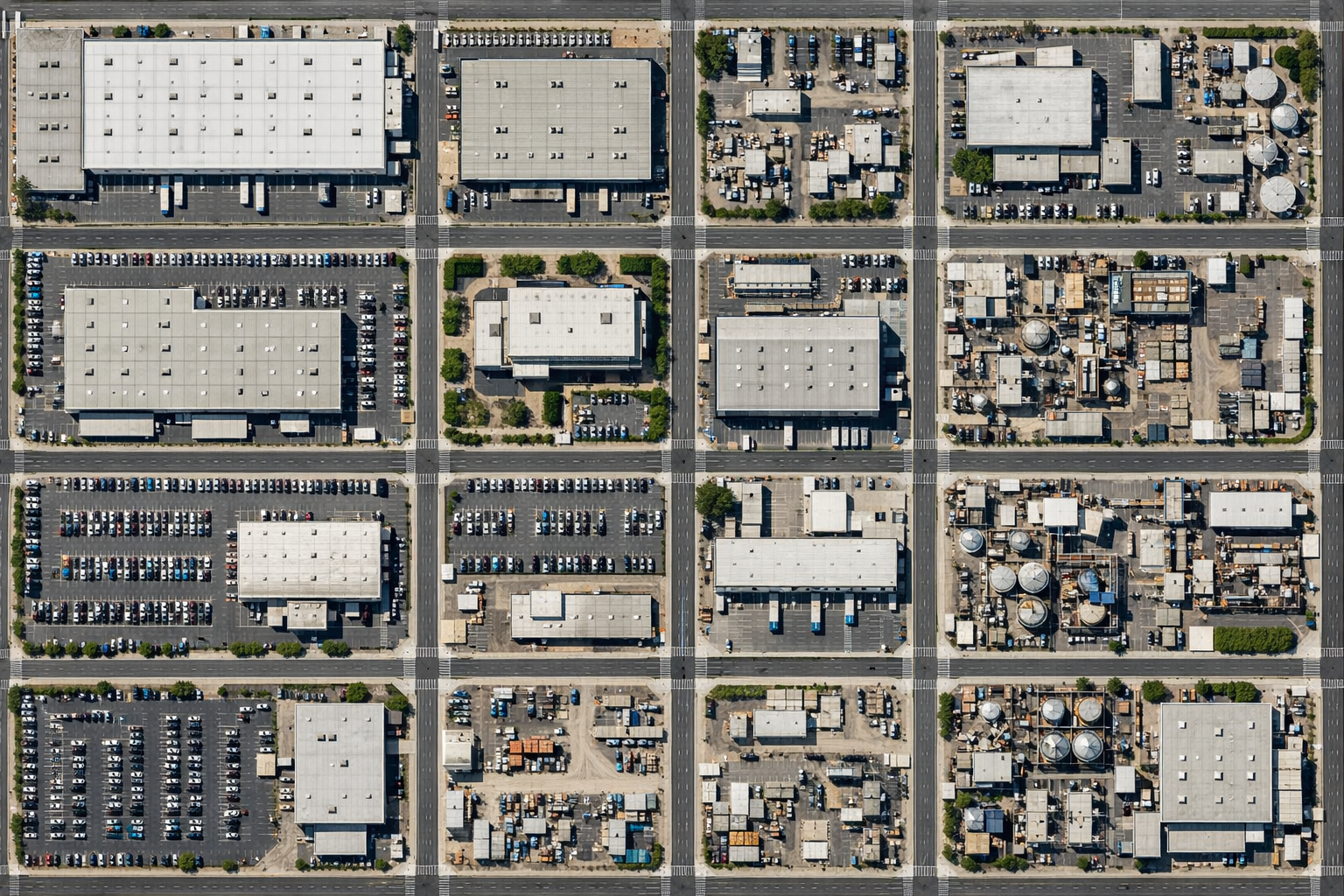
Construction & Infrastructure
Monitor project progress, track equipment, and verify compliance with precision aerial surveys. Reduce rework and optimize resource allocation.

Mining & Quarrying
Accurate volumetric analysis, slope stability assessment, and environmental monitoring for mining operations.

Land Development
Comprehensive site analysis and planning with precise topographic data for optimal development strategies.
Drone Services for Energy Infrastructure
Comprehensive aerial solutions for solar farms, pipelines, power grids, and telecommunications infrastructure. Reduce inspection time, improve safety, and ensure regulatory compliance with precision drone technology.

Solar Farm Inspection
Drone Services
- Panel Performance Analysis
- Thermal Imaging Inspection
- Defect Detection & Mapping
- Efficiency Assessment
- Maintenance Planning
- Quality Assurance Surveys
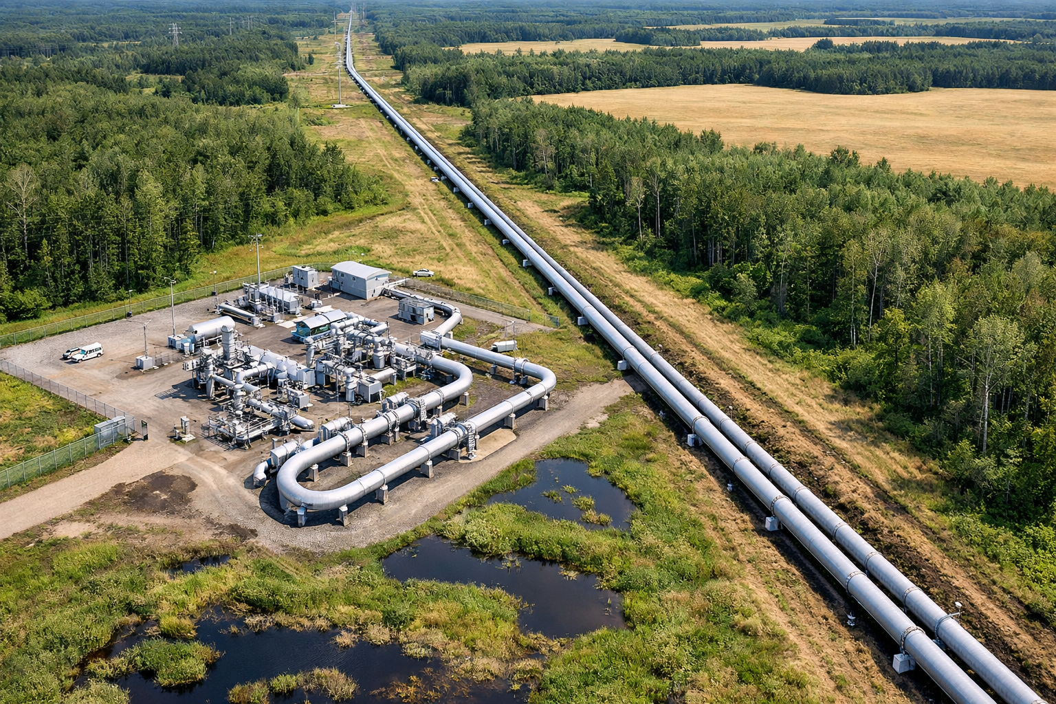
Pipeline Inspection
Drone Services
- Route Mapping & Documentation
- Leak Detection & Monitoring
- Corrosion Assessment
- Right-of-Way Surveys
- Environmental Impact Analysis
- Compliance Documentation
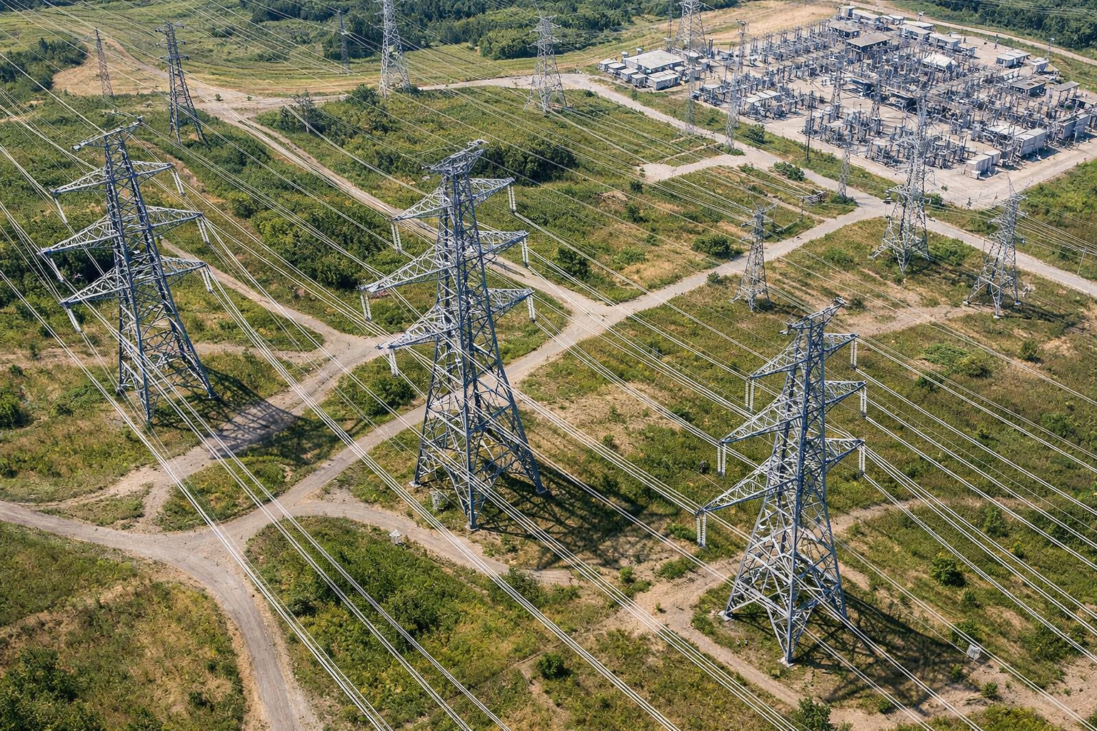
Power Grid Monitoring
Drone Services
- Transmission Line Inspection
- Tower Structural Assessment
- Vegetation Management
- Fault Detection
- Network Mapping
- Predictive Maintenance
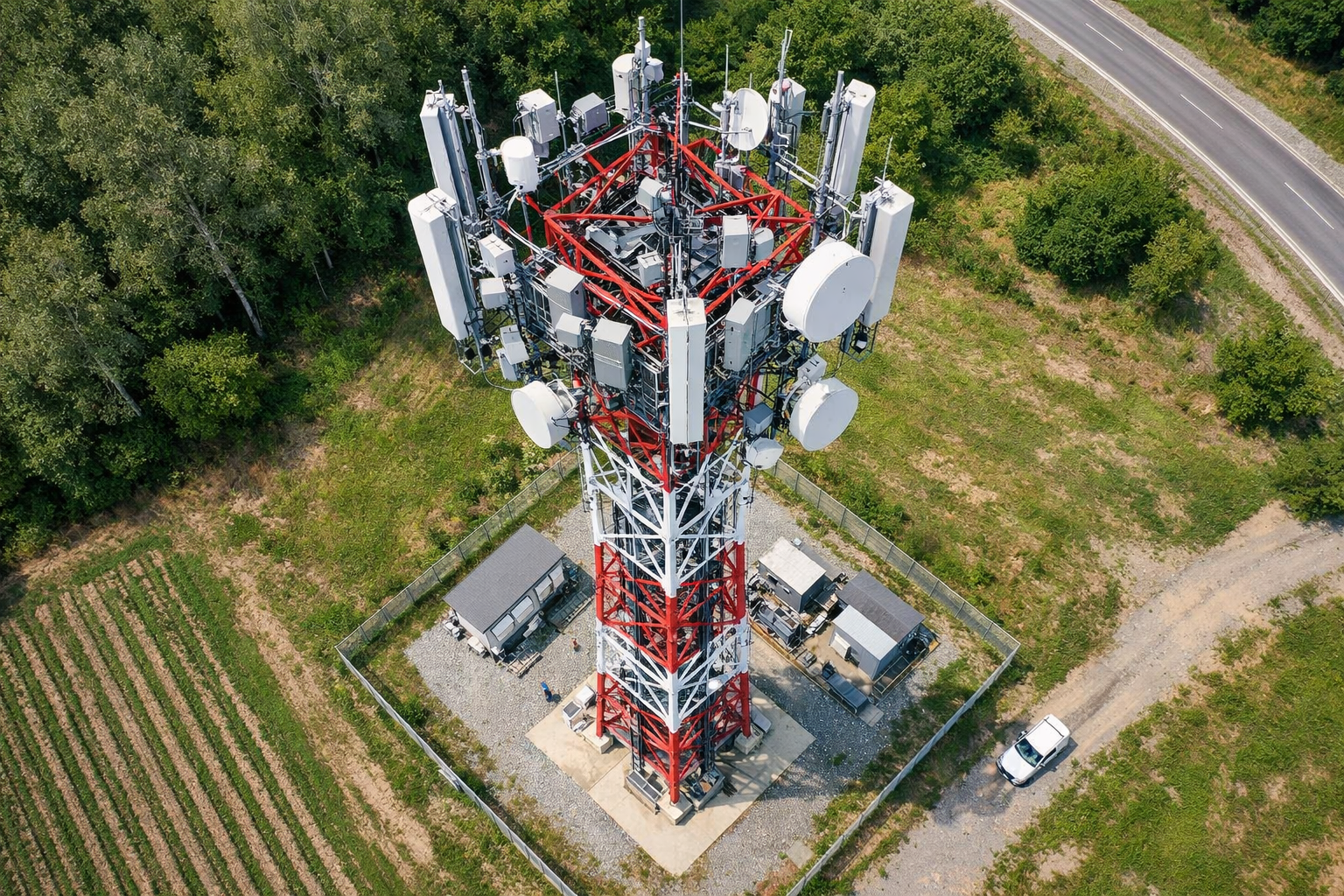
Telecommunication Tower
Drone Services
- Tower Inspection & Assessment
- Equipment Documentation
- Antenna Positioning Verification
- Structural Health Monitoring
- Site Surveys
- Compliance Verification
Why Choose Nolair for Energy Inspections?
Safety First
Eliminate worker exposure to hazardous environments with safe aerial inspections.
Rapid Deployment
Complete inspections in hours instead of days, minimizing operational disruptions.
High-Resolution Data
Capture detailed imagery and thermal data for comprehensive analysis and reporting.
Cost Effective
Reduce operational costs by minimizing equipment, personnel, and project timelines.
Cutting-Edge Technology
Leveraging the latest UAV platforms, sensors, and processing software to deliver survey-grade results.
Advanced Processing
State-of-the-art photogrammetry and LiDAR processing software for maximum accuracy and detail.
NCAA Certified
All operations conducted by NCAA certified pilots ensuring regulatory compliance and safety standards.
Real-Time Analysis
Rapid data processing and analysis enabling quick decision-making and immediate insights.
Cloud Integration
Secure cloud-based data storage and sharing for seamless collaboration across teams.
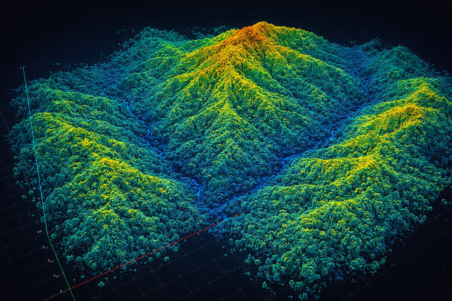
Advanced LiDAR Capabilities
Millimeter-accurate point cloud data with dense vegetation penetration
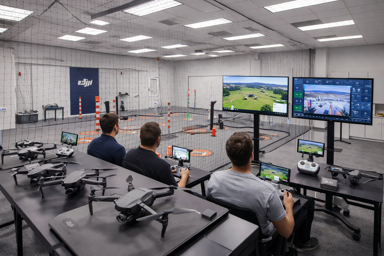
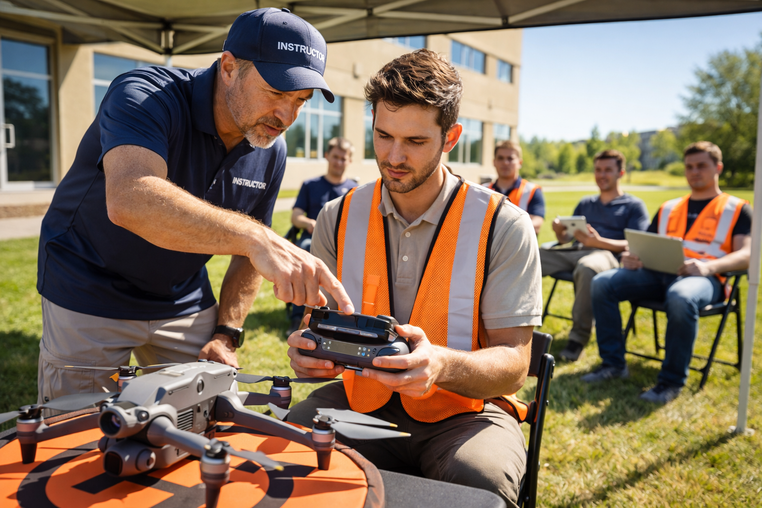
Professional Drone Training
Become a certified drone pilot with our comprehensive training programs. Learn from industry experts and gain hands-on experience with professional-grade equipment.

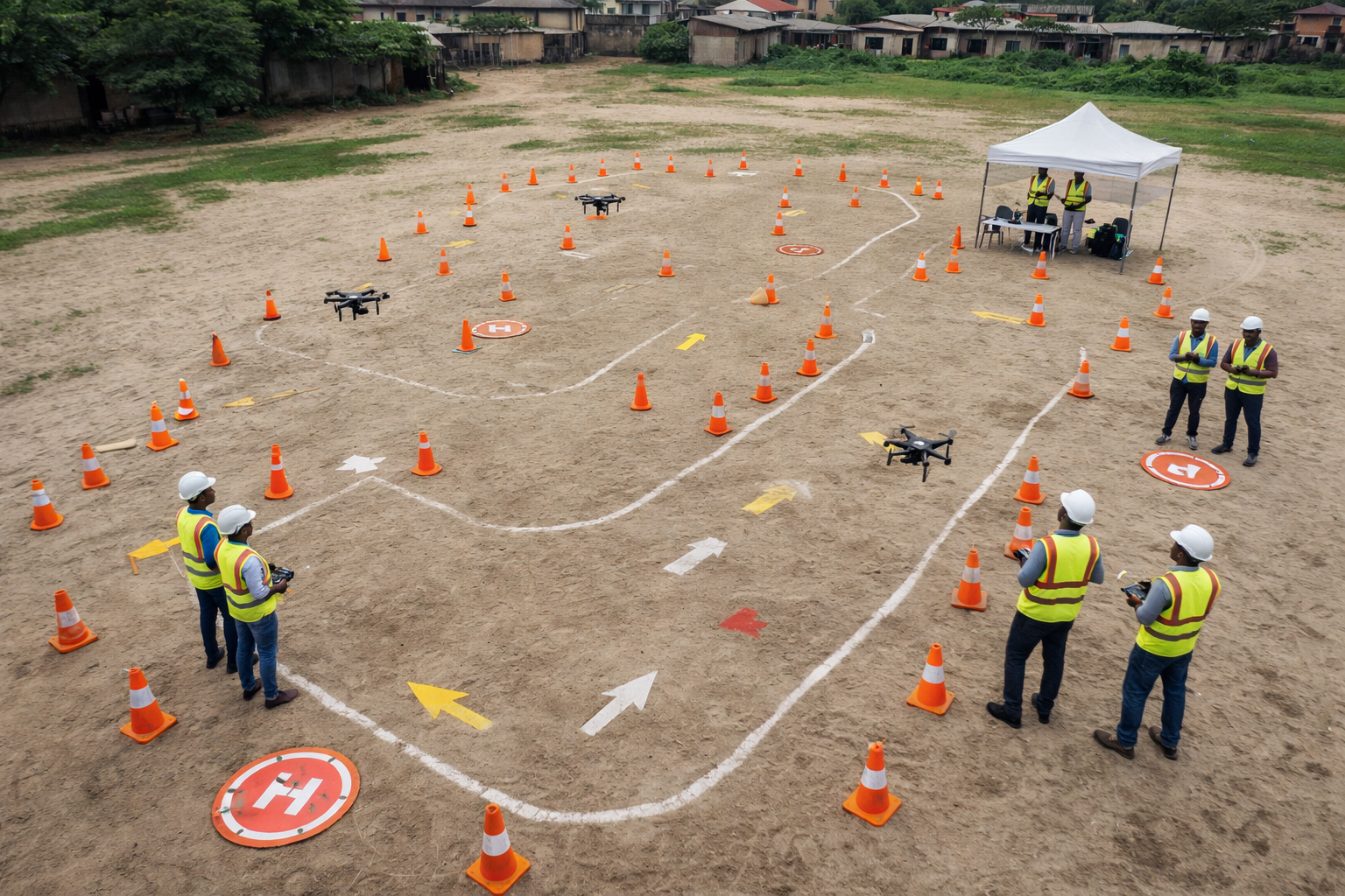
Beginner Pilot Course
Learn the fundamentals of drone operation, safety protocols, and basic flight maneuvers.
Topics Covered:
Advanced Mapping & Survey
Master professional mapping techniques, LiDAR operations, and data collection for surveying projects.
Topics Covered:
Professional Certification
Comprehensive program leading to NCAA certification for commercial drone operations.
Topics Covered:
Why Choose Our Training?
Expert Instructors
Learn from NCAA certified professionals with years of industry experience
Certification
Earn recognized credentials that open doors to professional opportunities
Hands-On Practice
Work with professional-grade DJI equipment in real-world scenarios
Comprehensive Curriculum
Cover all aspects from basics to advanced surveying and mapping techniques
Ready to Start Your Drone Pilot Journey?
Join our next training cohort and become a certified professional drone pilot. Limited spots available.
Enroll TodayDrone Customization & Upgrades
Tailor your drone fleet to meet specific project requirements. From sensor integration to software configuration, we deliver precision customization services.
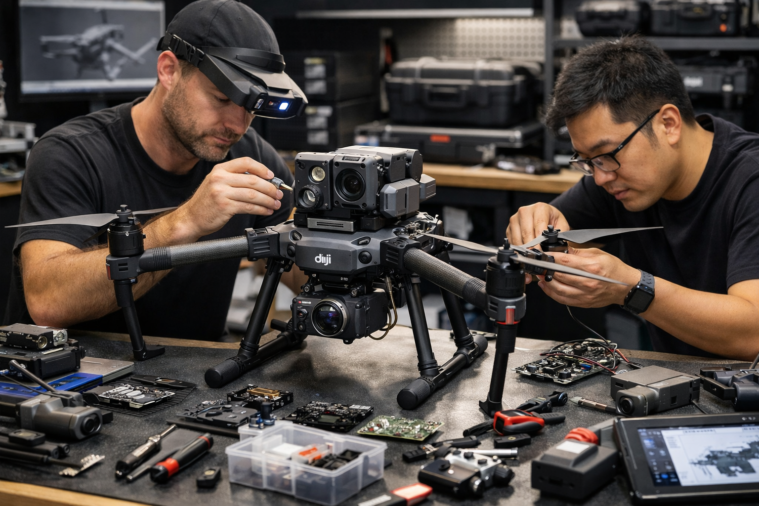
Sensor Upgrades
Install advanced thermal, multispectral, or LiDAR sensors for specialized applications.
Payload Integration
Custom payload mounting and integration for specialized equipment and sensors.
Software Configuration
Custom firmware and software setup for specific mission requirements and data workflows.
Maintenance & Repair
Comprehensive maintenance, repairs, and component replacement services.
Our Customization Process
Consultation
Discuss your specific requirements and mission objectives with our experts.
Design
Create a custom configuration plan tailored to your needs and budget.
Implementation
Carefully integrate and test all components and software configurations.
Validation
Perform comprehensive testing and quality assurance before delivery.
Advanced Integration
Seamless integration of complex sensor systems and payloads
Quality Assurance
Rigorous testing protocols ensure reliability and performance
Performance Optimization
Maximize flight time and payload capacity with expert tuning
Expert Support
Ongoing technical support and maintenance for all customizations
Transform Your Drone Fleet
Get expert customization and upgrade services to maximize your drone's capabilities for your specific missions.
Schedule ConsultationNolair Enterprise
Nolair Enterprise is a drone mapping and surveying company providing precise aerial data solutions for infrastructure, construction, and land development projects. We specialize in UAV-based photogrammetry, LiDAR mapping, orthomosaics, and 3D modeling, delivering survey-grade outputs through NCAA certified operations.
Nolair Enterprise helps clients reduce field time, improve accuracy, and make faster, data-driven decisions. Our commitment to excellence and innovation drives us to deliver exceptional results on every project.
Survey-Grade Accuracy
Precise data collection for professional surveying standards
NCAA Certified Operations
Fully compliant with all regulatory requirements
Advanced Technology
Latest DJI professional equipment and software
Our Capabilities
Mapping Services
UAV Photogrammetry, LiDAR Mapping, Orthomosaics
Data Solutions
3D Modeling, Point Cloud Processing, Analysis
Industries Served
Infrastructure, Construction, Mining, Land Development
Locations
Lagos, Enugu, and Abuja, Nigeria
Our Mission
To empower businesses across Africa with cutting-edge drone technology and data solutions that drive efficiency, accuracy, and growth in their operations.
Core Values
Precision
Survey-grade accuracy in every mission
Certification
NCAA certified operations and compliance
Expertise
Experienced professionals in drone technology
Reliability
Consistent delivery of high-quality results
Ready to Partner with Nolair Enterprise?
Let's discuss how our drone mapping and surveying solutions can transform your projects.
Get in TouchReady to Transform Your Projects?
Get in touch with our team to discuss how Nolair Enterprise can deliver precise aerial data solutions for your next project.
Phone
+234 916 014 0276